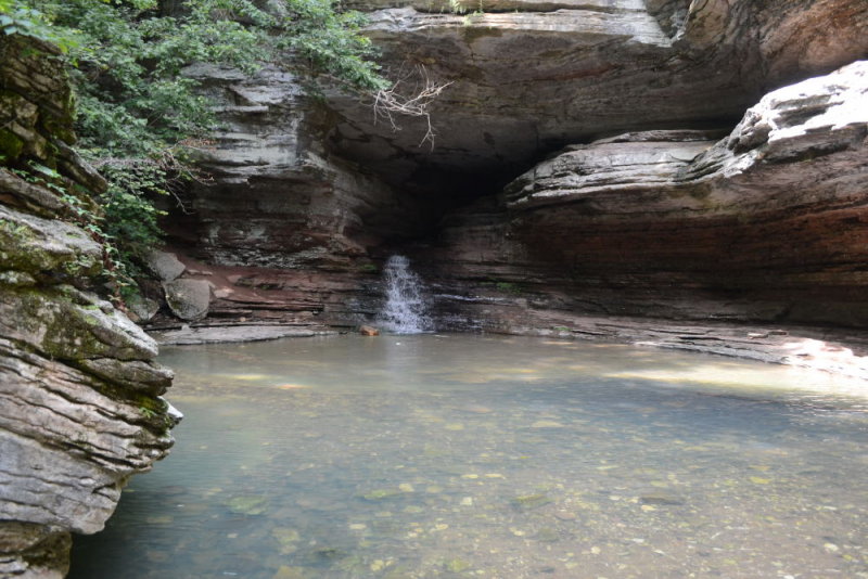
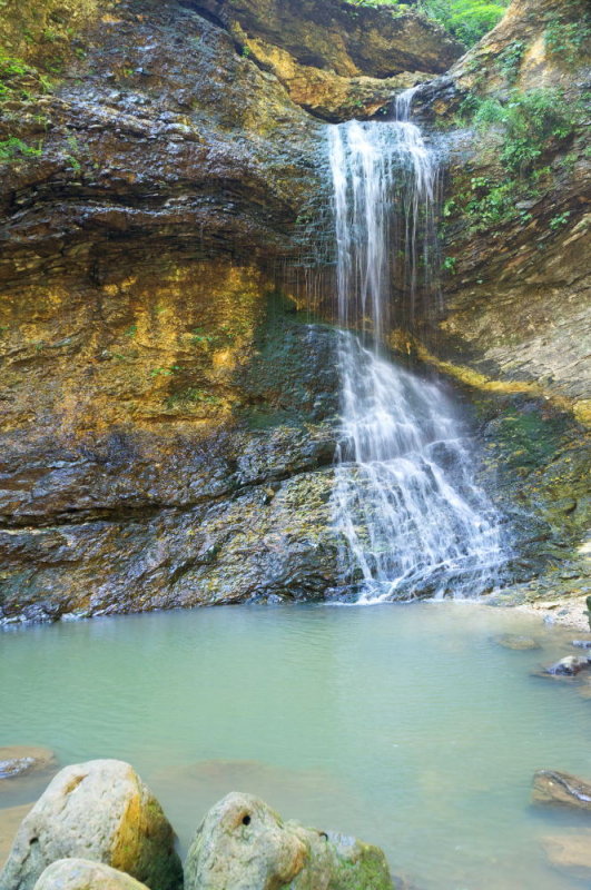
(Note: click here to see the entire collection of photos from Jasper.)
Navigator: 2012 2013 2015 2016
This page is a rather long posting, it's all on 1 single page, but within this long page I have it divided up into 5 separate sections.
Points of Interest
Places We Went
| Spot |
GPS Coordintes |
Maps |
Description |
| Texas BBQ, Atlanta TX |
33.12315, -94.17950 |
link |
A BBQ place we found near Atlanta TX on the way in. |
| Dogwood Springs Cabin |
36.02014, -93.17570 |
link |
The cabins we stayed in. |
| Ozark Campground |
36.06500, -93.15917 |
link |
Found in swimmingholes.org/ar.html, a swimming hole and scenic spot about 3 miles from the cabin. |
| Pruitt, Lower |
36.06139, -93.13888 |
link |
One of my favorite spots, about 3 miles from the cabin, with a great swimming hole and jumping spots (especially in the "Upper" section). |
| Bradley Park |
36.00387, -93.19468 |
link |
Sort of the "Gladewater Lake" of the area, a swimming spot in a city park within the city limits of Jasper, good for a "quick dip." |
| Lost Valley Trail |
36.01009, -93.37428 |
link |
A hiking trail about 15 miles from the cabins near Ponca. Many waterfalls can be found here if the water levels are good. |
| Ponca Access Bridge |
36.01870, -93.35710 |
link |
A spot my wife found, but which was in the books & at the website but I never noticed, one of my favorite swim spots (good scenery too). |
| Blue Hole |
35.99478, -93.04205 |
link |
Perhaps the best swim spot of them all, a "local secret" of sorts described to me by the cabin owners (although I later found it in one of the books too). |
| Carver |
35.98419, -93.04162 |
link |
A scenic spot near Blue Hole which I found by accident, may have swimming hole areas also but didn't try that. |
| Eagle Rock Cafe, Mt Judea |
35.92208, -93.06006 |
link |
An eatery we found near the Blue Hole, Carver and Sam's Throne (below). |
| Sam's Throne |
35.87917, -93.04472 |
link |
A good spot, which the cabin owners told me of, where you can get good "views" from high vantage points, hiking etc. |
Map View Of Spots (added 06-18-2015, click photo to enlarge JPEG screenshot)
(click here to view within Google Maps itself)
Introduction
In mid-2012 my wife & I were deciding where to go on a week's paid vacation. Places such as Kevin's in Brevard & Turner Falls in Oklahoma were pondered. The former didn't happen because of the long drive & because Kevin wouldn't be around for much of it due to work, the latter was ruled out when we noticed how hot it would be there (at the time, escaping extreme 100'F heat was a desire) & when several online reviews stated it had become a rather trashy place.
At the same time, my wife was wanting to see her grandfather Conley who lived in Butler MO, which was not far from Branson MO, where Silver Dollar City was located. Silver Dollar City was a place she had almost went to as a child until the family car broke down & she was wanting to check it out along with visiting her grandfather. All of that was fine in & of itself, but I didn't want such to hijack what I was really wanting for our vacation--relaxing scenery in a quiet place where I could get some great landscape shots & hopefully enjoy some splash holes too. At one point, I actually made a hotel reservation in Branson, figuring that's what our vacation was going to be.
Nonetheless, meanwhile I was still researching quiet/scenic places, and via swimmingholes.org/ar.html, I found some interesting entries in a small town in Arkansas called Jasper. They looked to have some scenic splash holes located in a region much like what I was hoping for--quiet and secluded. My wife then found some interesting cabins in the area, I
called & the guy was very helpful & made it sound like that the
area in fact was very scenic for getting good photos etc.
I then ran a Mapquest check & noticed that this town of Jasper was only 1 hour from Branson MO, where my wife was interested in visiting. It hit me--we could vacation in Jasper & then head up to Branson for one day when her grandfather could visit, and then resume Jasper afterwards. With that, we had found our place.
Here We Go!
(1) First Couple of Days
I
actually planned what to pack over a month in advance, and seemed to
remember everything, even things such as a can opener for opening cans
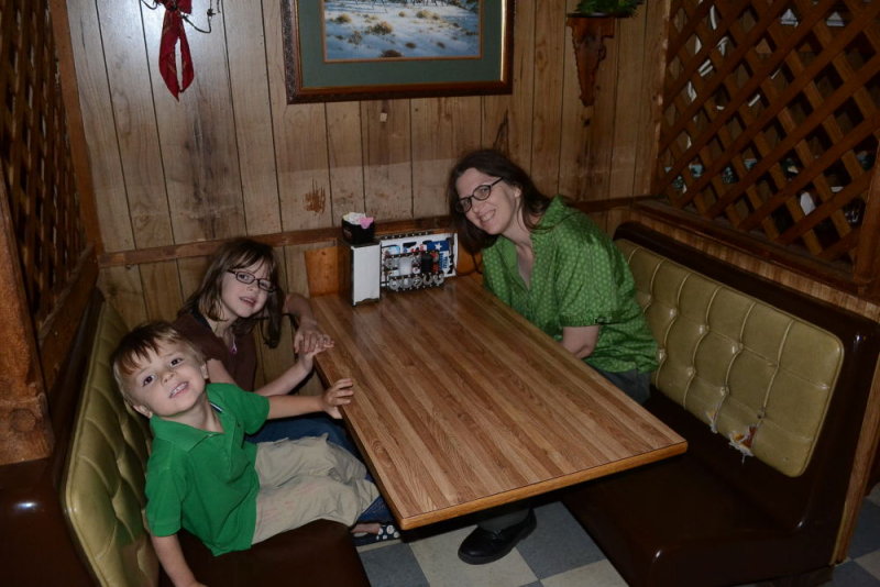
of food we'd buy to cook. Near Texarkana (TX/ARK border) was a little town called Atlanta TX, we saw a McDonald's & we were going to eat there but it was CROWDED. We kept going & saw a nice small eatery called "Texas BBQ" & decided to eat there.
 |
| Us Heading Out, Fred's In Kilgore TX |
 |
| Texas BBQ, Atlanta TX (GPS coordinates: 33.12315, -94.17950) |
 |
| Helen Being Friendly to a Stranger Vs Being Scared of Them, How Sweet/Adorable (And Safe!!) |
 |
| Good food, Naturally I Had a Zillion Pounds of Texas Toast, Ha ha |
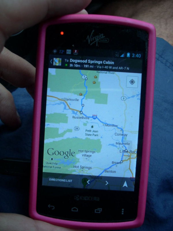
The scenery was pretty once you got out of Russellville & headed north on ARK-7.
 |
| View from "Grand Canyon of ARK" off ARK-7 |
However, we didn't realize how small the cabins were until we got there, charming though they were.
 |
| Charming on the Inside, If Small (Dogwood Springs: GPS Coordinates: 36.02014, -93.17570) |
|
|
|
|
|
|
|
|
 |
| Exterior Of Cabin--#13 (It Also Had a #14 Sort of Like a "Duplex," It was Vacant & Later We Had Both) |
Jasper ARK is a very small town, there was this humble little grocery store about ½ mile from the cabin.
We checked out "Ozark Campground" which had decent (but not great) swimming when we were there. Naturally I went for some scenic shots, this probably being the best one (un-retouched):
 |
| Ozark Campground (GPS Coordinates: 36.06500, -93.15917) |
After Ozark, we went to Pruitt, to me a better swimming hole (if not as good scenery); it's free & if the water level is high enough you may find people jumping from well high off of the bluffs.
 |
Pruitt, Lower. (GPS coordinates: 36.06139, -93.13888)
 |
| You can see people waiting to jump from the bluffs. |
|
Naturally, I wanted to get some good scenics at Pruitt, here was a good one.
 |
| Taken with my Olympus E-PL1 |
Also found: Bradley Park, I call it the "Lake Gladewater of Jasper" because it's right in the city and part of the city park, with no hiking involved. It's not as scenic as the other places, but still pretty good as a "quickie." That seems pretty similar to what Lake Gladewater is back home (although I would prefer Bradley Park over Lake Gladewater anyday just the same).
 | | |
| Bradley Park. (GPS Coordinates: 36.00387, -93.19468) |
(2) Lost Trails, "The Barn"
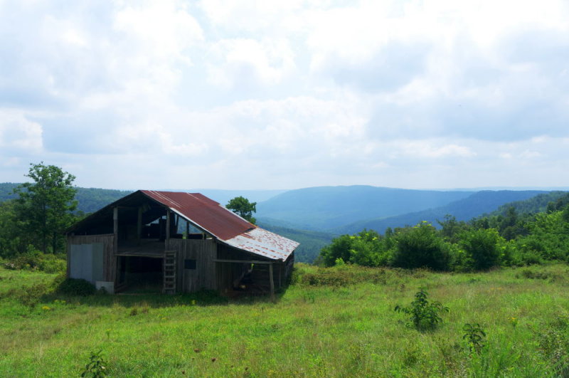
On Monday (day 3) we went up Highway 74 to check out some sights. Highway 74 is one of the main "scenic" roads in the area, leading to Ponca & Lost Trails, 2 attractions in the area. On the way I saw this barn & got a shot of it, it was the most scenic thing I saw on the entire trip and resulted in this outstanding photo:
 |
| Un-retouched shot, taken with the Olympus E-PL1 & CPL polarizer |
Prior to that, we had lunch at a little place called Sharon's Cafe.
Here is some more scenery up on the way on Highway 74.
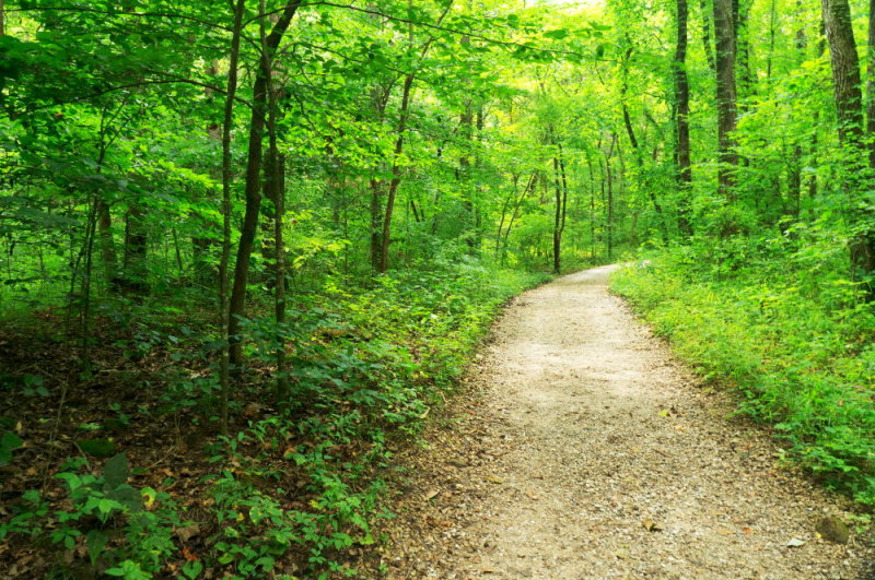
Our initial coordinates for Lost Trail were wrong, as they were for the actual vantage point & it tried to have us go down some really torn-up roads to get to that vantage spot, when the thing to do was get to the parking spots & hike there on foot. Once we found it (GPS coordinates: 36.01009, -93.37428), we headed on, the trail looked like this:
 |
| Not really one of my great shots, but oh well |
Lost Trails is supposed to have some pretty good waterfalls, but they were dry this year, as the Park Ranger told us once there. You can also apparently go through this cave with a flashlight to see a REALLY nice one, but again locals told us there wasn't really anything to see at this time. Here early-on is where you're supposed to see a little waterfall, it's supposed to be gushing between the large "hanging out" rock & the smaller one underneath it.
(3) Day 4 & 5--Her Family Arrives, Trip to Branson MO & We Find the Ponca Spot
Late the prior night, her family arrived & checked into cabin #18. On Day 4 (Tuesday), we went up to Branson MO to do the "obligatory family thing" of meeting up with her grandfather Bob Conley & his lady friend. Bryan/Stephanie had been in Branson anyway the entire time, my wife's sister (Sherri) & her kids & the mother-father (my in-laws) stayed in the #18 cabin.
We went up to Branson & met at a place called, I believe, Mel's Cafe (an old 50's type of cafe). Branson was a "tourist-y" place my wife & I quickly tired of (tons of traffic over people flocking to take a photo of a plastic Mickey Mouse, big woop-dee-doo we BOTH thought). After initially meeting at McDonald's we went on to the cafe. Naturally I got some "snaps" of Sherri's kids in that context, as I often have in similar situations:
After lunch, naturally there needed to be photos of all of us (after this little detour away from Jasper they darn well better have me or somebody take some, ha ha), we spotted an area underneath a tree on the grounds & a kind stranger took this shot (which I had to crop a little bit, as usual, they never get close enough):
 |
| 20120724_124511_nl_b_d3100 |
From there we ske-daddled back to Jasper, and stopped at "Table Rock Lake" along the way (Bryan/Stephanie were also there for a bit)
 |
| Naturally I attempted some "scenic" shots |
 |
| The kids sure enjoyed cooling off |
 |
| I let Helen swim all the way across (in her life jacket), I went too (she's that little-bitty dot seen just below the one boat on the left) |
Then, back at the cabin, we & her family enjoyed the pool.
The next day (Wednesday), her family were doing some other things in Branson (Silver Dollar City I think) while we went off on our own for a bit up Highway 74 (where Lost Trails/Ponca Access are).
 |
| Saw This Little Store/Eatery on the way Up Highway 74 |
 |
| Ha ha, "spools" for eating tables, ha ha |
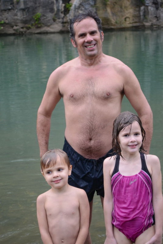
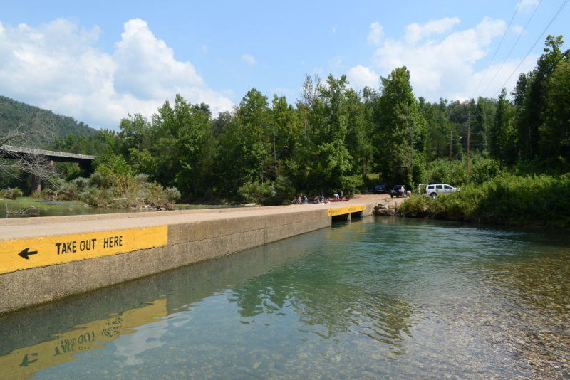
We tried Lost Trails again but again it was a flame-out again, but on the way back my wife spotted a jewel, Ponca Bridge (GPS coordinates: 36.01870, -93.35710), a spot which in fact was in the sites I had researched but failed to notice. It's a bridge overlooking the Buffalo River, it's only about 5-6 feet up, and locals use it as a swimming/jumping spot.
 |
| Ponca Bridge, You Swim Near the Bridge Area (8 feet deep or so, About 5-6 Ft High) |
 |
| Us, Ponca Bridge |
 |
| We Saw Them Swimming in the Water, They Took Our Picture (Above) | |
| |
|
|
 |
| Kids in the Water, Pretty Scenery Too |
 |
| The Old Guy On the Left Was Friendly & Chit-Chatting With me |
Ponca was very enjoyable, and we made a note to come back here the next day WITH her family & her sister's kids, we knew they'd enjoy jumping in the water from there.
After that excursion, we ate at this pizza place in downtown Jasper ARK, a combination pizza-place/bakery/muffins place.
 |
| The sign/menu |
 |
| Look at those muffins! |
 |
| Our table |
 |
| The food is here |
(4) Day 6, Thursday, All Of Us Enjoy Ponca Bridge Swimming & Ozark Cafe
We & her family (sister, her kids, mother-father) went to the Ponca Bridge (GPS coordinates: 36.01870, -93.35710) figuring they'd all enjoy jumping off of the bridge into the cooler water, and indeed they did. I also got some good scenic shots there that I didn't get yesterday.
 |
| Another "overview" shot of the bridge & swimming area |
 |
| Kids in the water |
 |
| Dylan sunbathing near an attractive woman hoping to get her phone number, ha ha |
|
 |
| Naturally, "big guy" (Mr. Conley) had to try & catch some fish |
 |
| The jump spot, my wife/her sister contemplating jumping in, you can see 2 of the kids already in it |
 |
| Wife's sister (Sherri) went in! Austin as well | |
I got some good scenic shots, here are probably the 2 best ones:
 |
| Taken with Olympus E-PL1 & CPL, straight from the camera (20120726_120856_sf_epl1) |
 |
| 20120726_120847_sf_epl1 |
We then ate at the Ozark Cafe in downtown Jasper (I believe after resting at the cabin for awhile, the wife had energy to go all over the place but the rest of us were tired & hungry).
 |
| Interior of Ozark Cafe |
 |
| The crowd--wow, is Sherri on the phone with JR all the way in Jasper? |
 |
| HA HA, They sell cow patties! (Look near the bottom.) |
#5--The Last 2 Days
Friday her family left early that morning, and it was our last full day. We decided to check out the Blue Hole, a spot the cabin owners had told us about, one that does well even during low water levels, they told us. To my amazement, we managed to go straight there using their "turn by the blue barn by the old hole" type of directions, we absolutely nailed it. Of course, though, we saved the spot on our GPS so we could return again in later years without goofing it up. (GPS coordinates: 35.99478, -93.04205)
It was, to me, the best swimming hole of all of it (though Ponca was a pretty close second) and we got some great scenic shots there as well. It was more off of the road & secluded than the other spots, & just a great experience overall.
 |
| What you see at the entrance, the "white fence" they told me to look for |
 |
| Scenery on the way in |
 |
| The scenery at the "Blue Hole" itself |
 |
| Where I took a dip, 8 feet deep or more, that rock was a jump-off platform |
Naturally, besides enjoying the dip (it was, again, probably the best one of the ones I had), I also got some scenic shots.
 |
| The best one, & probably my 2nd favorite from the entire trip (after the "barn" shot) |
 |
| Another scenic shot |
 |
| Another scenic shot |
 |
| Me "pimped" out with my cameras, ha ha (holding: Nikon D5100/18-105mm VR, around my neck: Olympus E-PL1) |
On the way from leaving, we happened to bump into a place called "Carver," (GPS coordinates: 35.98419, -93.04162) I got a couple of scenic shots from it .
 |
| Straight out of the camera, Olympus E-PL1, One of my favorites from the entire trip |
 |
| Another scenic shot from within "Carver" |
After this, we were on our way to a scenic overlook called "Sam's Throne," on the way we stopped at this charming little mom/pop cafe in Mt. Judea.
 |
| Eagle Rock Cafe, Mt Judea ARK. (GPS coordinates: 35.92208, -93.06006) |
 |
| Interior of the place |
 |
| Hamburger Steak, Mashed Potatoes & Green Beans |
 |
| Yes, I Love Texas Toast, Ha Ha |
From there we headed to Sam's Throne (GPS coordinates: 35.87917, -93.04472) to get something I had been wanting: an "overlook" spot for good photos from up-high. The owners at the cabin told us about this spot but I don't recall the lady giving us directions, I'm not sure how we got them unless someone at the restaurant told us how to get there (we didn't have these coordinates at the time, we got them from saving the spot once we found it).
 |
| Pretty good view |
 |
| Another pretty good view |
 |
| Pretty nice |
 |
| This spot didn't disappoint |
 |
| Just what I had been looking for during this trip, pretty scenic photographs |
After all of this, we went to Harrison ARK (a decent-sized city about 30 minutes north of Jasper) and ate at an Italian restaurant for our last night in Jasper.
 |
| My life LOVES Italian food |
GPS Coordinates: Documenting Where We Went
As I mention in my
GPS Coordinates post, as part of planning for this trip I was concerned because I correctly figured that we would find many places "on the fly" or with "turn by the barn directions" and then save these spots on our GPS. However, in the past when I've done this any such "on the fly" spots would become lost if the unit became broken, because you didn't get there with an address you can remember or look up again later, and by default nothing in the details of this favorite gave you any information that could used to replicate this spot again on another GPS (or Google Maps etc). Thus any "favorites" we saved on our Garmin Nuvi GPS would then be "locked" into this GPS exclusively and thus prone to being lost once the GPS unit inevitably was broken or misplaced. How could we save these spots outside of the GPS system so that we would never lose them even once the unit was lost or broken?
The answer was GPS coordinates, and I learned about that prior to this trip (see that post for more details), all I would need to do later was "extract" the coordinates from each favorite and document them, and with that, we would forever have a record of the spot and be able to go again later in the future easily. On this last day, "closing down day" as it were, where you're packing some things and otherwise preparing for leaving so that departure day isn't so hectic, I sat at the Wi-Fi spot by the pool with 1 of our 2 laptops and with our GPS, "extracting" the coordinates of every spot, "plugging" the number in Google Maps to make sure they were correct, and then typing them up in an email I sent to myself. I later updated my sites (this blog and my PBase) with those numbers as well.
With that, the next day, it was time to go. I enjoyed spots like Ponca & Bradley Park enough that it was tempting to enjoy them one last time on the way out (something we DID do in 2013), but instead there was a sense of it being time to get on back-home, which we did after taking these few "parting shots:"
 |
| Time to go! |
 |
| Cabin owner who was so nice (and chatty! ha ha) |
 |
| Helen Strangling One of the Owner's Children (Ha Ha) |
 |
| Adrian (far left), Helen (far right), 2 of their kids in the middle |
 |
| The pool |
 |
| You can almost see Helen saying "bye bye" in this |
 |
| Ate at "Cracker Barrel" at Arkadelphia ARK, one of the last stops |
----END----