Click here to view all the photos.
Navigator: 2012 2013 2015 2016
Note: with any photo you see, you can click on it to view it at an enlarged size (then hit the ESC key to return to the page).
Other trips involving family, notable my father in March & my wife's grandmother in July in Tucson, came up as a priority this year. However, I was still determined that we would still go to Jasper, even if for less time. In fact we did, it was for 4 days (counting the days we left) but it was still a pretty memorable trip.
I had saved the GPS coordinates from last year's trip & also had since purchased a book called "Swimming Holes of The Ozarks" (Glenn W. Wheeler) and referenced some swimming hole spots of interest. I forgot the atlas, which would matter a bit later, but otherwise I remembered pretty much everything, as with last year.
(1) Day 1
       Departure
       Texas BBQ in Atlanta TX
       Bradley Park
       Settling into Cabin
(2) Day 2
       Ponca Bridge
       Lost Trail (With Great Photos)
       Lower Pruitt
(3) Day 3
       Bradley Park
       Falling Waterfalls
       Pedestal Rocks King's Bluff Lookout
       Upper/Lower Pruitt
       Ozark Cafe
(4) Day 4
       Departure Day
       Steel Creek
       Ponca Bridge Again
       Hardee's in Russellville
|
|
| Spot |
GPS Coordinates |
Link |
Description |
| Texas BBQ, Atlanta TX |
33.12315, -94.17950 |
link |
Great BBQ on the way |
| Bradley Park |
36.00387, -93.19468 |
link |
Good "quick dip" spot at small park within Jasper |
| Dogwood Springs Cabin |
36.02014, -93.17570 |
link |
Cabins we stayed at |
| Ponca Access Bridge |
36.01870, -93.35710 |
link |
Great swim spot, can jump off short bridge |
| Lost Valley Trail |
36.01009, -93.37428 |
link |
Good hiking/waterfall area |
| Pruitt, Lower |
36.06139, -93.13888 |
link |
Good swimming/beach/jump area close to cabin |
| Falling Water Waterfalls |
35.72194, -92.94944 |
link |
From book: ~1 hr from Jasper, good jump/swim spot |
| Pedestal Rock King's Bluff |
35.72371, -93.01443 |
link |
So-so hiking/scenic spot we stumbled across |
| Steel Creek |
36.02977, -93.34217 |
link |
Swim/canoe/short hike spot (near Ponca etc) |
|
(1) Day 1--Departure, Food, Bradley Park, Settling into Cabin
Although we still had the same car from last year, the 2002 Saturn SL1, and it was still doing fine, we had also since added a 2004 Oldsmobile Alero and decided to do that this year, since it had a V6 that made it better for climbing the hilly roads you encounter as you near Jasper itself. I also wanted to return to Texas BBQ from last year, I couldn't recall exactly where it was except that it was near the McDonald's in Atlanta TX, which is outside Texarkana where you get on I-30 to really begin the trip in earnest. I managed to find it pretty easily, and saved its coordinates (33.12315, -94.17950) for the future.
 |
| Texas BBQ, Great Food (GPS Coordinates: 33.12315, -94.17950) |
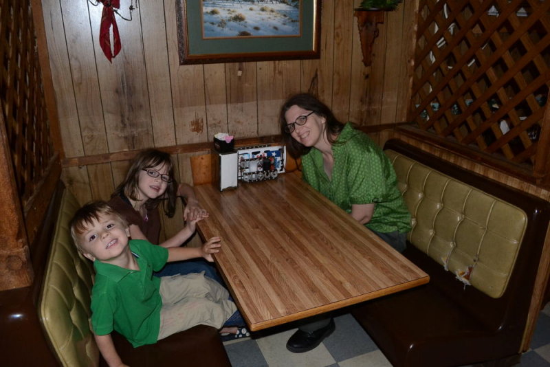 |
| Us Getting Ready To Eat |
 |
Also got corn-on-the-cob and most excellent baked beans. My own sauce
is off to the right-hand side. |
Last year I got "beef brisket," this year I got a sandwich (chopped beef), I was eager to see how my Well's BBQ Sauce (from NC) would make it taste, it did very well.
I wanted to make sure we were equipped GPS-wise, I bought both models we had.
 |
The one on the left is the one we used, the other was a spare/backup,
when Bryan went to Jasper in Sept, I lent him that one. |
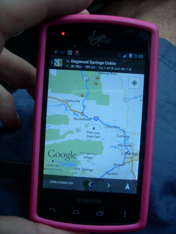 |
Also used my phone, Kyocera Rise, for a "bird's eye" type
of overview. I also had "starred" some places from the book. |
We got to the Jasper ARK area around 7:30 p.m., I had us go to Bradley Park, the small swimming hole in town, before going to the cabin. The water was cold at first, but ultimately felt good.
 |
Bradley Park, a "quick grab" shot just to show we were here
(GPS coordinates: 36.00387, -93.19468) |
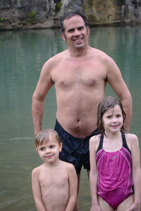 |
| The kids went too, although it was somewhat cold to them |
With that we went to the cabin. We got the same unit, housing #13 and #14, only this time we started out with #14 (vs #13 last time). From there we settled in, with the kids playing in the play area just beside it, and then we walked to the nearby grocery store to get some food, including sausage biscuits for the morning & the ingredients for me to make the jalapeno chicken chili in my $4 roaster.
 |
| We started out with cabin #14 this time |
 |
| Another view inside of cabin #14 |
 |
| Wife posing on big tire in playground |
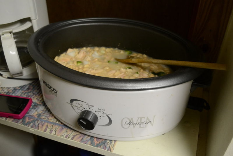 |
I made my famous jalapeno chicken chili in this $4 "roaster" (working as a slow cooker),
it cooked overnight was ready the next morning |
(2) Day 2--Ponca Bridge, Lost Trail (With Great Photos)
GPS coordinates
36.01009, -93.37428 (Ponca Bridge)
36.01009, -93.37428 (Lost Trail)
36.06139, -93.13888 (Pruitt, Lower) |
Our first full day in Jasper, I awoke to the smell of the Jalapeno Chicken Chili, while the other 3 helped themselves to the microwave sausage biscuits we stocked up on. I sat on the porch filling up on the chili as the kids played in the play area, with the crisp cool air (about 58'F) setting the mood perfectly. We later added #13 on so that we had the whole duplex to ourselves again as last year, this time with we 2 staying in #14 and the kids sleeping in #13 (the reverse of last year). Naturally I took photos of the surrounding areas around the cabin.
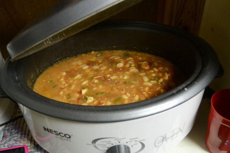 |
| The chili was ready, mmm mmm good! |
 |
| The cabin, this time we're in the rear-part in #14 initially |
 |
| Here is the playground, maybe 5-10 seconds from the cabin |
Ponca
We went up 74 to go to Ponca, one of my favorite spots from last year. (I was saddened to learn that the "Blue Hole" was closed this year, bummer.) Naturally I had to try & repeat the "barn shot" from last year, which was on that road.
 |
| Here I go, having at it (this year with my Sony NEX-C3) |
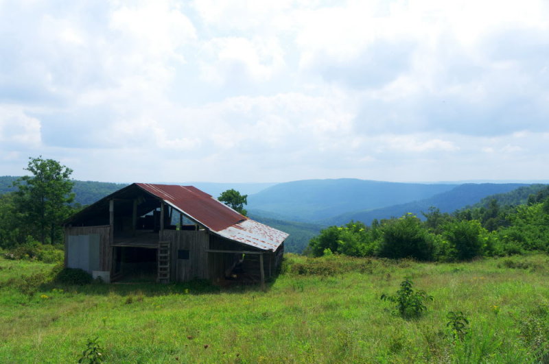 |
I was initially disappointed vs last year's version of this, but it later
grew on me, it's still pretty darned nice |
Here we are, at Ponca Bridge, one of my favorites from last year. I think the water was higher than last year, too.
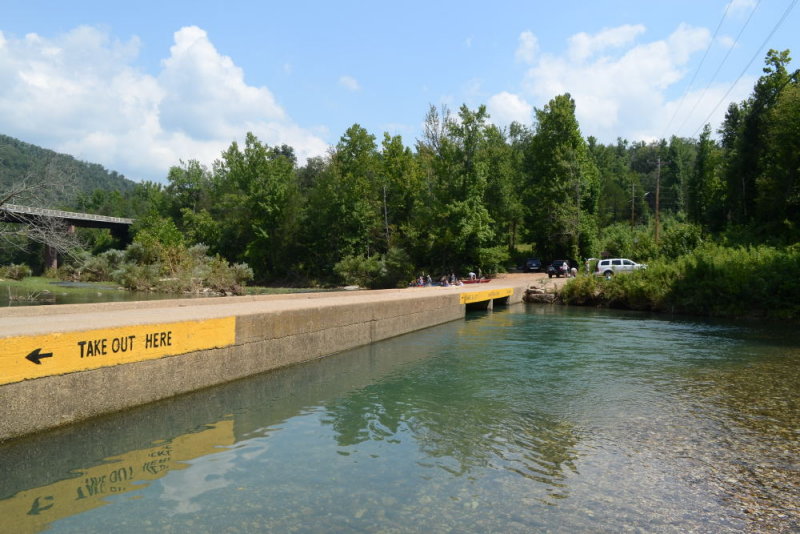 |
| Ponca Bridge (GPS Coordinates: 36.01870, -93.35710) |
 |
There he goes, Adrian (notice people setting up
to canoe in the background) |
 |
| Adrian again |
 |
| My turn! |
 |
| Weee! |
 |
| Adrian sure seems to be enjoying himself |
 |
| Adrian & Helen |
Lost Trail
From there, we decided to try Lost Trail out again, a place my wife had wanted us to explore last year but was something of a flame-out. Such was NOT the case this year, the water was higher, the waterfalls were better, and I got me some of the most killer shots ever, perhaps the best of the entire trip.
 |
Hiking entrance into Lost Trail
(GPS coordinates: 36.01009, -93.37428) |
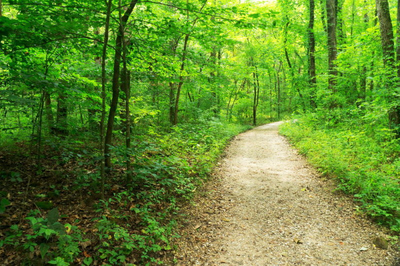 |
| One of my good shots: scenery early-in at Lost Trail |
Last year, when we got about 0.4 miles in, there was supposed to be a small waterfall, but it was practically bone-dry. This year, it was flowing somewhat, and I got some killer photos of it as well as another waterfall right after it (called "Eden Falls" if I recall).
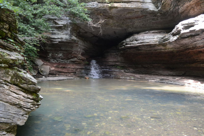 |
The first waterfall you see. It's about 10 feet tall & you're
easily able to walk up to it in water about waist-deep. |
 |
What a shot, it may be the shot of the year. Used my Sony NEX-C3 & 18-55mm,
this was at 1/13 second & ISO 800(!) |
 |
| A sign for the next falls that you see, Eden Falls |
 |
Here I am, hard at play, with my Sony NEX-C3 outfit
(love how light it is & its image quality is outstanding) |
 |
| Helen making herself at home |
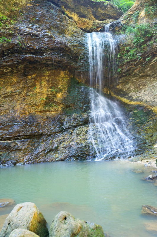 |
The 2nd waterfall ("Eden"), one of my killer scenic shots.
Again, 1/13 second & ISO 800, what a camera! |
This one group of goofy-acting tourists (from the Middle East?) reminded me about the need for taking silly shots too; they saw me snapping the falls & asked me to snap a photo with their camera of them posing by the falls, which I did. (I also showed them me snapping a goofy photo of MYSELF with their camera, ha ha.)
 |
My wife snapped this picture herself while I was snapping them
with my camera, glad she did that so I could remember this |
 |
| My turn to act silly for a minute |
 |
| Now all of us (except mommy, whom I couldn't get to join us, nah!!) |
 |
| Adrian sure made himself comfortable there |
 |
| Had to pose for a shot just before leaving |
There are also these falls you can see by crawling through a cave
with a
flashlight, but we also didn't bother this year, especially since these
were pretty good & that maneuver involved an uphill trek my wife
didn't think she could handle. Regardless, it was a success, as this
spot was one she had wanted to return to on account of it flopping out
the prior year.
Pruitt (Lower)
This is one of our favorite spots to take a dip in, it's right near the cabin maybe 4 miles down the road on ARK 7. It's also one I think my brother-in-law Bryan might like, as it has spots on the "bluffs" where you can jump into the water from pretty high up.
 |
| Helen/Adrian splashing around the edge |
 |
| Helen |
 |
| Adrian |
 |
The scenery, that bridge is ARK-7, coming from the cabin this
is on the right-hand side (you park on the left-hand side) |
 |
| Us Preparing to Jump in From Low (There Are Higher Spots Available Also) |
(3) Day 3--Bradley Park, Falling Waterfalls, Pedestal Rocks King's Bluff Lookout, Upper/Lower Pruitt, Ozark Cafe
GPS coordinates
36.00387, -93.19468 (Bradley Park)
35.72194, -92.94944 (Falling Waterfalls)
35.72371, -93.01443 (Pedestal Rocks King's Bluff Lookout)
36.06139, -93.13888 (Pruitt, Lower) |
The morning was started off with my wife checking out a small yard sale going on, which I was anxious for us to not do, we were on vacation after all, but she did get a couple of nice outfits for the kids, so we took photos of them in the cabin's play area.
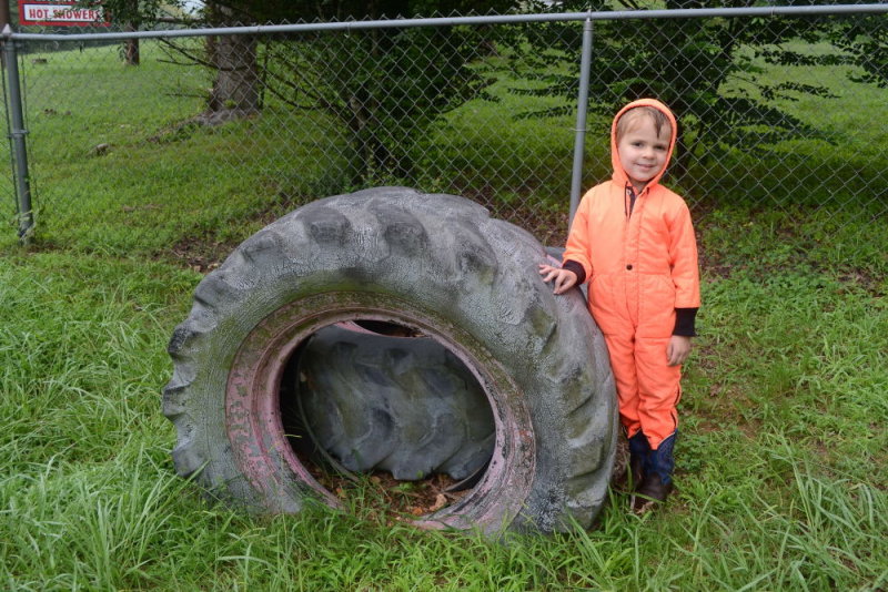 |
| This orange "jumpsuit" just looked so cute on him |
 |
| Helen was cute too |
My wife had the
desire to check out some of the waterfalls from our waterfall book, and I
wanted to enjoy some swimming holes as usual, especially as it was now a
bit warmer (around 80'F vs 75'F) and it was also sunnier. We mapped out
several waterfalls in the Ben Hur area for potential exploration (see
the photos pages
for more details). A swimming hole I was interested in also happened to
be right in the same area as those waterfalls, thus satisfying my main
priority. With that, our plans for the day were set.
First, though, I had us stop at Bradley Park in town for a quick dip, I also wanted to get some scenic shots there again as I was unhappy with the "quick snaps" from the 1st day.
 |
One of my really good scenic shots from this trip,
used my Sony NEX-C3 kit and CPL polarizer. |
 |
While I was doing that, wife had the kids in the nearby park, taking
photos such as this one |
From there, we took on off, with the "Falling Waterfalls" swimming hole the 1st stop, and the waterfalls to follow. Here you see the waterfalls book with the spots she was wanting to check out:
 |
Page 88 of the book, she was especially wanting to check
out "Intersection" but the others were close-by as well |
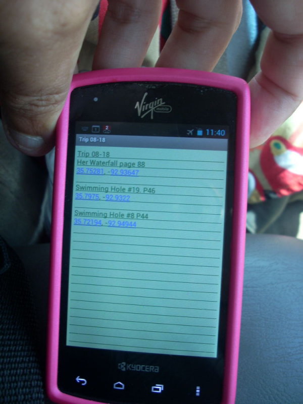 |
I sent myself a note to my phone (via Wi-Fi from the cabin) with the coordinates of the spots,
I was especially interested in #8 (p 44), "Falling Waterfalls" which we in fact went to |
The GPS (Garmin Nuvi, not phone, the Virgin Mobile phone didn't work in this area) did a silly thing, we were heading west 123 & needed to get on 16 heading east, which 123 did eventually by intersecting with 7 which then hit 16; however, the GPS sent us down some raggly gravel path off 123 to hit 16, when we'd much preferred just staying on the smoother paved roads. Not having the Atlas with us, I couldn't see that as I would've otherwise (or my phone's GPS in "bird's eye" view, my phone worked very little in that area due to lack of Virgin Mobile service). We did okay, though.
The "Falling Waterfalls" GPS coordinates were dead-on, after 1-2 miles on a smooth gravel-y road, it said "arriving" right dead-on cue from when we saw the falls. It was a great place to jump in & cool-off (well it would've been had I not been too scared of heights to jump, ha ha). Photos follow.
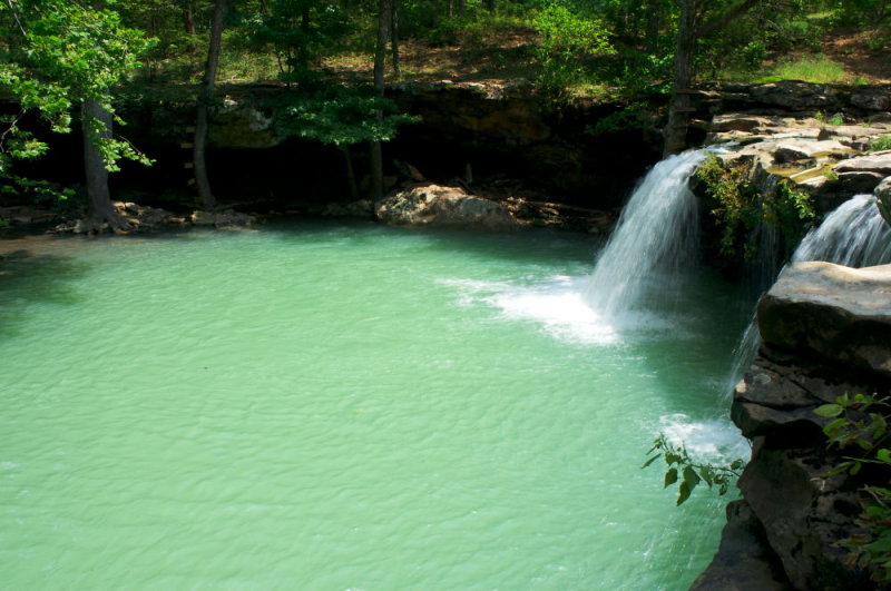 |
| My best "scenic" shot of the falls, taken again with the Sony NEX-C3 & CPL polarizer |
 |
Adrian jumped in from that short ledge
(bottom of photo) & cooled off |
 |
Helen too |
None of her waterfalls seemed to pan out, the one listed was supposed to be on the same road as this hole, but locals said they didn't recall seeing any falls, & the road was too bumpy for me anyway.
Pedestal Rocks King's Bluff Scenic Overlook
Without an Atlas & with my phone GPS not working it was hard to improvise new spots "on the fly," driving around we came across this "overlook" spot (called "Pedestal Rocks King's Bluff") where we could possibly get some good elevated views & photos, so we checked it out.
 |
| Sign for the overlook (GPS coordinates: 35.72371, -93.01443) |
 |
| You walked down a trail that looked like this |
The stop ended up being something of a waste, we were anxious for some reason (and Adrian got pretty banged up doing the hike, even if it was an easy one), we were hungry also & the views weren't that great, & it turned out "Sam's Throne" (a good scenic spot from last year) and the cafe (Eagle Rock) we ate prior to checking "Sam's Throne" out both were within 20-odd minutes of here anyway. (Again, even with me having those coordinates, it's hard to see such without a "bird's eye" view courtesy of an Atlas or the phone's GPS etc or some "offline" map viewing software on a laptop).
Still, we got some shots of the views while there.
 |
| The scenery wasn't as pretty as other places, but oh well |
 |
| Another photo showing the view |
 |
| View, again |
Afterwards, I pointed the GPS to Carver, a spot from last year which we liked & apparently wasn't that far away, and we were going to go there, but our bones were tired & hungry & we couldn't think of a place to eat nearby (we forgot about the Eagle Rock Cafe which was nearby & good) so we went back to the Jasper area & went to Pruitt, this time initially going to the UPPER Pruitt vs the LOWER Pruitt to try & make it a bit different. Ultimately, though, we decided we liked Lower better, and went there shortly afterwards.
 |
A "scenic" shot of Upper Pruitt, you see it's on the left-side
of the bridge (coming from Jasper) |
 |
| Another view of "Upper" Pruitt, looking the other direction |
 |
| A shot of "Lower" Pruitt, which we all liked better |
 |
Me preparing to jump in from "Lower" Pruitt, I can imagine Bryan
jumping in from up higher (where the greenery is) |
 |
| A pretty nice picture of me at "Lower" Pruitt |
From there, we then ate at Ozark Cafe. Money was tighter than before & this was basically our only eat-out day since arriving. (I'd been eating that Jalapeno Chicken Chili almost the whole time & was starting to get tired of it, ha ha.)
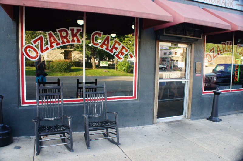 |
| Ozark Cafe |
 |
| I just got a basic hamburger & added french fries |
 |
They actually had Country Bob's steak sauce.
My in-laws would've LOVED seeing that. |
 |
Helen & this old guy sitting in the chairs in front of the Ozark Cafe.
That old guy really found her funny & was smiling a lot. |
(4) Day 4--We Leave: Departure, Steel Creek, Ponca Access Bridge
GPS coordinates
36.00963, -93.30074 (Barn Shot)
36.02977, -93.34217 (Steel Creek)
36.01870, -93.35710 (Ponca Access Bridge) |
Today was the day to leave. However, I wanted to visit Ponca Access Bridge again, and we also went to Steel Creek which was on the way. Last year when we left the day of departure we just left, this time I wanted to cram in these 2 places first.
First, though, I wanted to get some more photos of the cabin, especially the inside.
 |
First, some "departure" pictures of the cabin. Bedroom of cabin #13
(the "main" one last year, the "add-on" this year) |
 |
| Another view of room #13, through the door you go to #14 |
 |
| Oh yes, we have some packing to do! |
From there, we were going to enjoy Ponca and then eat at Hardee's in Russellville (which is which point I consider us really to have left Jasper, partially because my phone resumes service there). First, though, we also checked out Steel Creek Campground, which we only "brushed" with briefly last year, & of course I got some scenic photos up Highway 74 on the way.
 |
| Views up Highway 74 |
 |
| My wife tried her hand out with the "barn shot" on the way |
 |
| The barn had horses (didn't see any last year) & my wife was enthralled |
 |
Here we are at Steel Creek, along with many canoers
who apparently launch from there |
 |
| Helen decided to cool off |
 |
| So did Adrian |
 |
This one spot near the "horse farm" part of it was better for taking a dip, & I also got some killer scenic shots there.
This one is probably the best one, the polarizer REALLY brought up the sky/cloud richness. |
 |
| Some more scenery, looking the other way (not as good of a picture) |
Now is was time for Ponca before leaving. Besides getting to take another good dip at one of my favorite places to do so, it also gave me a chance to try again to get good scenic shots, and I did, MUCH better ones than before.
 |
| "Overall" scenery (the jump-in spot is to the right) |
 |
| I don't know why I feel the need to think before jumping in, especially here |
 |
| There I go! Weeeee! |
 |
| There goes Adrian |
 |
| Helen's Turn |
 |
| I got some great scenic shots, here's one |
 |
| This scenic shot is just OUTSTANDING to me, wow |
 |
| As we were winding down, she naturally took some shots of the kids there |
 |
| One more for the road, weeee! |
From there we headed on home, and knowing that there was a Hardee's in Russellville, we of course had to stop.
 |
| Too bad we couldn't make it there in time for breakfast (without spoiling our Steel Creek/Ponca Bridge trips) |
 |
| We each got the "$5 bag" specials--mine was with a Double Hamburger & Chicken Sandwich (the included apple turnover was good too) |
----END OF FILE----


No comments:
Post a Comment